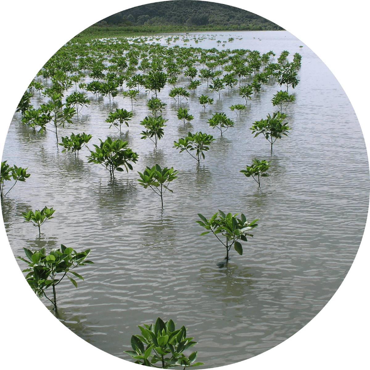
"The Nature Conservancy (TNC) has closed on a land acquisition along the Gila River in southwestern New Mexico. . . . TNC will mimic a successful wetland restoration project that began on the Gila River Farm several years ago, which has shown to increase biodiversity in the area. TNC expects to create another new wetland on the newly acquired land that will clean and filter water before entering the river. Restoration work like this created habitat that is used every summer by the southwestern willow flycatcher and the western yellow-billed cuckoo, among other birds and wildlife."
"The confluence of the tiny San Pedro River and the much larger Gila was once one of the richest locales in one of the most productive river ecosystems in the American Southwest, an incomparable oasis of biodiversity . . . The confluence now is a very different place, its richness long diminished. A massive mountain of orange- and dun-colored smelter tailings, left from the days of copper and lead processing and riddled with arsenic, towers where the two rivers meet. Water rarely flows there, with an occasional summer downpour delivering an ephemeral trickle."
The M.H. Dutch Salmon Greater Gila Wild and Scenic River Act is established "to amend the Wild and Scenic Rivers Act to designate certain segments of the Gila River system in the State of New Mexico as components of the National Wild and Scenic Rivers System, to provide for the transfer of administrative jurisdiction over certain Federal land in the State of New Mexico, and for other purposes." The act provided further protection to the Gila River.
"After 5 years . . . the Gila River Diversion proposal is now effectively dead. The Interstate Stream Commission voted 7-2 Thursday against supplying funding needed to complete an environmental impact statement required for the project . . . The proposal would have seen 14,000 acre-feet of water diverted each year from the Gila River for landowners to use in New Mexico."
"On April 16 [2019], American Rivers announced their annual most endangered rivers list, a yearly marker for the health of rivers, and in 2019, the Gila was number one. Scientists estimate that, due to climate change, the snowpack that feeds the Gila will be gone by mid-century and flows will shrink by up to 10 percent over the same period. Global warming is wringing the river dry, and a proposed major diversion project that could pull 14,000 acre feet—about the equivalent of the yearly water use for 30,000 households—out of the river each year, stressing it even further."
"It was a stream, and standing on the band I could see they if you picked out a riffle, you could cross on foot without wetting your knees. Hardly even your ankles . . . This Gila would ground a canoe."
"Organized in 1984 to protect the free flow of the Gila and San Francisco Rivers and the wilderness characteristics of the Gila and Aldo Leopold Wilderness areas, the Gila Conservation Coalition (GCC) is a partnership of local environmental and conservation groups and concerned individuals that promote conservation of the Upper Gila River Basin and surrounding lands." Through grassroots organizing, the GCC played a pivotal role in preventing the construction of the proposed Hooker and Conner Dam proposals, ensuring the protection of the Gila River.
The Forest Service's 1924 designation of the Gila Wilderness began the nationwide network of Wilderness areas, culminating in the National Wilderness Act of 1964. The Wilderness Act of 1964 is created "to establish a National Wilderness Preservation System for the permanent good of the whole people, and for other purposes . . . to be composed of federally owned areas designated by Congress as "wilderness areas", and these shall be administered for the use and enjoyment of the American people in such manner as will leave them unimpaired for future use and enjoyment as wilderness, and so as to provide for the protection of these areas, the preservation of their wilderness character, and for the gathering and dissemination of information regarding their use and enjoyment as wilderness."
"Now the river is an empty bed full of sand. Now you can stand in that same place and see the wind tearing pieces of bark off the cottonwood trees along the dry ditches. The dead trees stand there like white bones. The red-wing blackbirds have gone somewhere else."
“The place that they were now to look upon as home was a strange looking spectrala in the midst of a desert . . . There was a scarcity of water, and people were immediately warned that their per capita consumption must be held to a minimum. Furthermore, there were only occasional taps that must be frivolous faucets for use, say, to cool a scorching earth . . . Few had actually anticipated a desert. The very name of Gila River had naturally intimated green and abundant water. Several actually packed their fishing equipment in the firm belief that such a river would afford them fishing. Weeks later some of this first contingent may have spoken of their bitter reactions when they first had a glimpse of the fury of the desert.”
"When the dam was completed there would be plenty of water. And there was. For about five years. Then the water began to run short again. After another five years it stopped altogether."
"On June 3rd, 1924, the Forest Service accepted [Aldo] Leopold’s proposal and set aside more than 500,000-acres of mountains, rivers, and desert surrounding the Gila River. It became the first federally-recognized Wilderness area in the country, and it would serve as a model for wilderness preservation to come."
"The famous Gila is not a very imposing stream at any time, and now was no stream at all, but a shallow dry channel, choked with desert dust, or paved with curling flakes of baked mud which cracked like bits of broken pottery under our ponies' feet."
"there was a series of wet years with abundance of natural forage. The ranges built up rapidly, and overgrazing resulted . . . At the end of this series of wet years came the disastrous flood of 1891. Before this, flood waters of the Gila merely spread out over the flats and irrigated them. Now with the banks of the river unprotected by brush and grass, the channel suddenly widened, and many good ranches along the river were cut out. Smaller branches of the river in the upper basin cut channels as much as twelve feet deep. On the desert deep channels appeared in what had been grass swales."


Learn about Maya Lin’s fifth and final memorial: a multi-platform science based artwork that presents an ecological history of our world - past, present, and future.

Discover ecological histories and stories of former abundance, loss, and recovery on the map of memory.
Learn how we can reduce our emissions and protect and restore species and habitats – around the world.

See how art can help us rethink the problems we face, and give us hope that each one of us can make a difference.

Help make a global memorial something personal and close to home. Share your stories of the natural world.